

One picnic table in the water; ducks swimming over a dock in the park. Photo by M. Mair
I don’t know how to describe what we are going through except as a slow flood. First the water rises, slowly and inexorably. Then it stabilizes for a short while; if the wind is from the right direction, if it blows offshore, the level may even go down. But then it creeps upward again. This is how it’s been for weeks now. We watch the water creep up the fixed docks and through their slats, retreat for a short while, then flood back again.

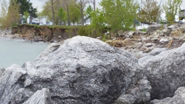
The raised section has been raised again. Photo by M. Mair.
So much depends on the wind and rain. A few days ago, when the rain was falling hard and the wind was high out of the east, waves ate more of the shoreline around us. A bench where people used to sit and gaze out over the lake is now in the lake with the soil it sat on, and so are some of the trees that grew close to it on the spit of land that curves around and protects the marina from the lake outside. The public boat launch remains under water. The beach to our east grows ever smaller.
Bench in the water, trees on the edge. Photo by M. Mair.
Some of our floating docks are developing a definite twist as a the chains that hold them reach the end of their scope; the fixed docks are more often underwater than not and many have now been modified to create a raised area down the middle to walk on. The walking area of the dock around the floating houses has had to be raised twice now. Around the marina, the lake and the lagoon where the yacht clubs are plants that once decorated the water’s edge are trying to grow up through the water, drowned roots notwithstanding. And around the lake we’re among the lucky ones.

Docks on the verge. Photo by M. Mair.
At least some of the birds and animals seem to be thriving. Snails take advantage of any wetness to try to cross the paved paths we walk. Birds feed on the clouds of midges or the worms trying to escape the wet earth or the bugs that are thriving in the damp – though some of the places those same birds usually nest are underwater. The lone deer we have seen so far this year enjoys nibbling the now-lush greenery, and fades away easily among the leafy bushes that are thriving on the hill by the road. The squirrels are busy in the trees. One group of raccoons has already found its way on to and been evicted from a friend’s boat, and from time to time we catch glimpses of their distinctive silhouettes in the fading light. Only the mink have been noticeable for their absence.

Debris outside the marina. Photo by M. Mair.
There are official warnings to visitors to take care along the waterfront, like this one from the Toronto and Region Conservation Authority:
“TRCA’s Scarborough Waterfront Team is warning of risks due to landslides and shoreline erosion along the Bluffs…The Project Team would like to caution the public who walk along or up/down the Scarborough Bluffs and waterfront areas. The Bluffs have become saturated with water. Landslides are more likely to occur in these conditions. Paths are being eroded, as well as the beach.”
(Ironically part of this is an area where the same body plans to increase access to difficult-to-reach beach areas to the east of us – as far as I can see from their maps if that plan had already been carried through the planned paths would have been affected or destroyed by the rising lake levels and wind-created waves as well as being in the path of possible landslides along the bluffs.)

Wave debris is scattered across a path in the marina. Photo by M. Mair.
These are the same bluffs that tower above us when we walk, less often now, to the nearby beach. Their lower slopes are covered by trees and bushes; above them precipitous bare slopes rise to overhanging lips where grass and trees are visible; bulrushes grow tall along the ditch beside the roadway where water that runs down the road and off the bluffs collects. We know that the clay that forms the bluffs grows more slippery as it grows wetter and we have noticed small slips in a few places. Our sense of caution grows stronger when the rain falls hard. And we notice that the city has recently installed a gate on the road that runs past the yacht clubs to the beach. They have not told us why, but obviously someone envisions a time when that gate may need to be closed.

Looking up at the Bluffs. Photo by M. Mair.
Since the beach that we have watched so many enjoy has become more and more eroded it seems likely that the usual summer camps will be curtailed or not take place here, and we’ll have to wait and see what happens about lifeguards and swimming. In the Toronto Islands, we already know, summer camps and other programs and summer attractions will not start until July 31st or later. The city has posted the following notice on its website:
“As of June 3, Toronto Police Services will begin lifeguarding some mainland beaches, where possible. Staff will continue to monitor the situation and will continually increase lifeguard levels as beach conditions require it. Public Health will begin posting beach water quality test results on June 6. Beach grooming and cleaning will start when the water recedes and where grooming equipment can access the beaches.”

The beach, with two lifeguard chairs now in the water. Photo by M. Mair.
The longer all this continues the more difficult it becomes for those affected. Homes have been flooded, land drowned, businesses hurt, jobs lost; there has been anger, frustration, attributions of blame, pleas for help. I don’t know how much or what could have been prevented or reduced by planning and foresight, but I do know that the main contributor to all of this is something we cannot control. Unless we find a way to control the rainfall and the weather.
Nature has spoken and we must listen. Until we develop an effective way to respond we can only wait and hope for things to ease soon.
*****
Here is the official description of the situation from the June 2nd communication of the US Army Corp of Engineers:
“By the end of May, Lakes Erie and Ontario had received over 150% and 180% of normal total May precipitation, respectively…
“All lakes are at higher levels than one month ago. Lakes Superior, Michigan-Huron, and St. Clair have risen 4 to 5 inches since May 2, while Lake Erie has risen 7 inches and Lake Ontario has risen 12 inches. Lake Ontario’s level is 4 inches above the record high monthly mean June level. Lake Ontario’s provisional mean May level was 248.69 ft, which is nearly 2 inches above the prior record high level of 248.56 ft. Over the next 30 days, Lakes Superior, Michigan-Huron, and St. Clair are forecast to rise 3, 2, and 1 inch respectively. Lakes Erie and Ontario are forecast to begin their seasonal decline during the next month, ending the 30-day period 1 and 3 inches lower than their June 2 levels. Note that while this forecast indicates an overall decline of 3 inches by July 2 on Lake Ontario, higher levels may be attained before the decline begins.”
And from the International Joint Commission that monitors and tries to maintain safe water levels:
“On 1 June 2017, Lake Ontario was 75.87 m (248.9 ft), 82 cm (32.3 inches) above its long-term average level for this time of year. The level at Lake St. Lawrence was about 28 cm (11.0 inches) above average, while the level at Lake St. Louis was about 22.49 m (73.8 ft), 108 cm (42.5 inches) above average. At Montreal Harbour, the level was 141 cm (55.5 inches) above average. Downstream, the flooding which has caused evacuations around Lake St. Peter is prolonged. ”. ..
As you can see, Lake Ontario is affected by the lakes and rivers that are part of the watershed or above it and there is flooding downstream. The situation is complex and will not be resolved quickly.
Written by Margaret Mair
Photos by Margaret Mair
